


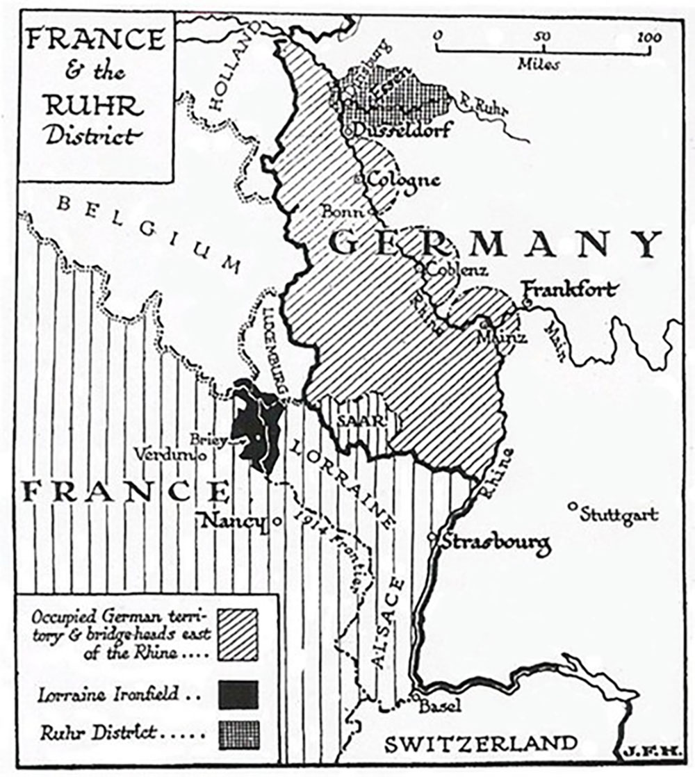
France & the Ruhr District
To Use This Document
With Your Students
Date
February 3, 1923
Description
Map of the Allied occupation of the Rhineland and the Ruhr area created by socialist writer and cartoonist, J. F. Horrabin. The creation of this map came less than a month after France and Belgium's decision to expand the Allied occupation zone, which had existed since the end of World War I, into the heavily industrialized Ruhr Valley. Despite hopes that this would allow the Allies to acquire the reparations demanded of Germany, its main results were a worsening of Weimar Germany's economic crisis, the galvanization of German civilians against the Allied Powers, and the popularization of the Nazi Party. The occupation ended in 1925.
Type
Map
Region
Global
Era
Turn of the Century and WWI
Topic
Global History and Geography, World War I, World War II
Repository
Source
"The Communist," February 3, 1923. Published by the Communist Party of Great Britain. Accessed on the Marxists Internet Archive: https://www.marxists.org/archive/horrabin/1923/02/ruhr.htm
Rights
This image is provided for education and research purposes. Rights may be reserved. Responsibility for securing permissions to distribute, publish, reproduce or other use rests with the user. For additional information, see our Copyright and Use Statement.